
Navigating a Winter of Extremes: El Niño & the Polar Vortex

A very strong El Niño joins forces with a powerful Polar Vortex to deny the Northern Hemisphere of snow this winter.
Welcome to a winter of contrasts! As we navigate through this season, two major climatic players are shaping our snowy landscapes in the Northwest and pretty much the Northern Hemisphere: the very strong El Niño and the ever-mysterious Polar Vortex. Let's dive into how these forces have affected our winter so far and what they might bring to Mt. Hood's slopes in the coming months.
The El Niño Effect:
This year, NOAA has upgraded its forecast from moderate to strong, to a very strong El Niño, one of the strongest since 1950. See my August snowfall prediction, which at this point, may be hard to meet. For the uninitiated, El Niño is a climatic phenomenon characterized by warmer ocean temperatures in the central and eastern Pacific Ocean. This typically leads to warmer and wetter conditions in the Pacific Northwest. My analysis shows that during such strong El Niño events, Government Camp on Mt. Hood sees an average snowfall of around 207 inches, notably lower than the long-term average.
Very Strong El Niño Years and Snowfall:
1997-98: 222.8 inches of snow (-33 inches from average)
2015-16: 197.3 inches of snow (-58.5 inches from average)
1982-83: 201 inches of snow (-54.8 inches from average)
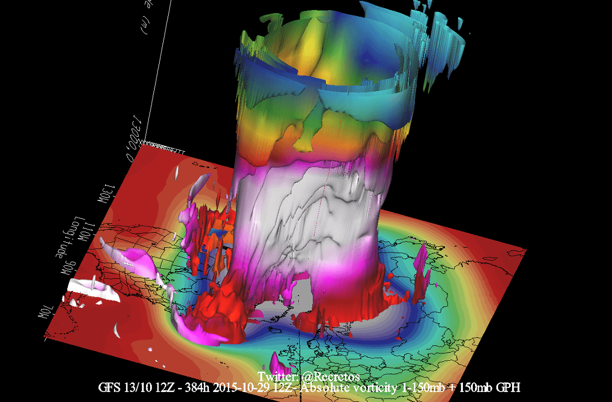
The Polar Vortex traps frigid arctic air.
Enter the Polar Vortex:
Our winter tale wouldn't be complete without mentioning the Polar Vortex, a massive whirl of cold air swirling over the Arctic. When strong, it acts like a refrigerated lid, keeping the coldest air locked up north. This, combined with a strong El Niño, has likely contributed to milder and less snowy conditions on Mt. Hood this season.
Current Winter Scenario:
So far, the duo of a strong El Niño and a robust Polar Vortex has led to reduced snow accumulation across the Northern Hemisphere, including the usually snow reliable Mt. Hood. Skiers and snowboarders have felt the pinch, with the slopes seeing less of the powdery white stuff than usual.
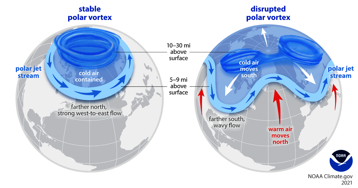
Once disrupted, cold air escapes the Polar Vortex to be disrtibuted by the jet stream.
But Wait, There's a Twist - The Weakening Polar Vortex:
Recently, there's been chatter about the Polar Vortex weakening (Severe Weather Europe). This can lead to it spilling its cold contents southward, bringing sudden cold snaps and potentially increasing snowfall. If this happens, it could counteract some of El Niño's warming effects, bringing more snow to our beloved Mt. Hood.
Predictions for the Rest of the Season:
If the Polar Vortex continues to weaken, we should see a mid-to-late-season surge in snowfall, starting by mid January. This could mean a delayed but delightful season for snow enthusiasts, with fresh powder gracing the slopes of Mt. Hood more frequently through the latter part of winter. However, the exact outcome will depend on the interplay of these climatic giants and other atmospheric patterns.
Conclusion:
While we've faced a slower start to the snow season due to a very strong El Niño and a solid Polar Vortex, the potential weakening of the Vortex could be a game-changer. For now, keep your skis waxed and your eyes on the forecast. Mother Nature might just have a few snowy surprises up her sleeve for Mt. Hood!
Stay tuned and stay hopeful for more snow!

DALL-E Prompt: Graphic of a Polar Vortex in an epic battle with El Niño over the northern hemisphere. The Polar Vortex swirls over the arctic trapping frigid air while El Niño send powerful waves of precipitation over North America but starving the NW United States of snow. Global perspective showing the battle.
I remain optimistic that even an El Niño can deliver a solid season once January kicks into gear. And while Santa may not have delivered a lot of snow yet this Christmas, there’s hope for a return to normal in the New Year.

DALL-E Prompt: Santa Claus in his sleigh delivering snow to a northwest ski area.
Keep doing your snow dances, and remember..